
اخبار العرب-كندا 24: الأحد 31 مارس 2024 09:02 مساءً
Winter is like an annoying houseguest this time of year. It makes a mess, overstays its welcome, and can’t seem to take a hint that we’re ready for some rest.
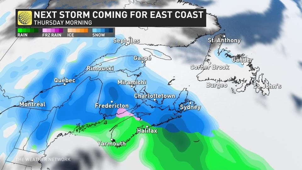
There’s no leaving winter behind for Atlantic Canada this week, unfortunately, as a coastal storm expected to develop by the middle of the week threatens another widespread dose of wintry weather as we head into the beginning of April.
Disruptions are likely across the Maritimes beginning Wednesday night and lasting into Thursday morning as wintry weather spreads over the region.
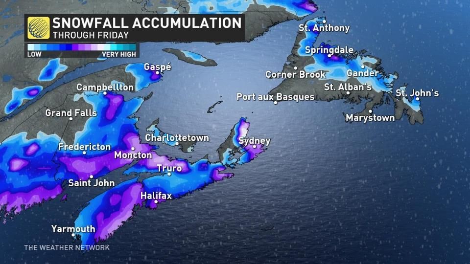
It’s not going to be a long-lived dose of snow, thankfully, but snowfall totals of 10+ cm are possible in spots before precipitation transitions over to rain. Travel issues are likely for a time.
DON'T MISS: Everything you need to know for April's spectacular and rare solar eclipse

The skies over the eastern half of Canada are a complicated mess this week as several disturbances interact with one another.
We’re on the lookout for a potent coastal low expected to develop over New England during the day Wednesday. A steady supply of tropical moisture streaming in from the south will allow this robust system to churn out lots of precipitation along its path.

Precipitation will begin pushing into the southern Maritimes late Wednesday evening as the low-pressure system slowly tracks north.
Cold air locked in place over the region will allow precipitation to begin as snow Wednesday night. Snow will gradually spread north through the overnight hours into Thursday morning.

Warm and gusty winds on the southern side of our coastal storm will allow temperatures to quickly rise above freezing, forcing snow to switch to rain from south to north through the day Thursday. This will limit accumulations and the duration of travel impacts.
Given that we’re still about four days away from the storm’s peak, it’s still too early for precise snowfall totals. It’s likely that some areas could see 10+ cm of snow out of this system before the changeover to rain, especially across northern portions of the Maritimes.
Story continues
Expect travel issues and a slow Thursday morning commute in areas with snow-slicked roads.
Conditions will remain chilly behind this system as we head into the first weekend of April, with much warmer temperatures likely by the second weekend of the month.
Forecasters will continue to monitor conditions ahead of the total solar eclipse that’ll traverse the region on Monday, April 8.
Stay with The Weather Network for all the latest on conditions across Atlantic Canada.
WATCH: Early signs point to hope for eclipse watchers in Canada
Click here to view the video
تم ادراج الخبر والعهده على المصدر، الرجاء الكتابة الينا لاي توضبح - برجاء اخبارنا بريديا عن خروقات لحقوق النشر للغير


