اخبار العرب-كندا 24: الخميس 8 يناير 2026 02:57 مساءً
Glimmers of hope appear even amid the roughest days of winter’s grip.
Canadians across the country look forward to a phenomenon known as the ‘January thaw’ every season—but what exactly is that, anyway?
DON'T MISS: January is Canada’s snowiest month. Here’s what you can expect
The middle of January is historically the coldest stretch of the year for most cities across the country. We’re deep in the heart of winter with spring still many weeks down the road.
Advertisement
Advertisement
Advertisement
Advertisement
Just when it feels like an impossibly long wait for the warm season to arrive, things tend to warm up even if only for a little while.

January Thaw Explainer
A January thaw occurs when we get a stretch of days with temperatures coming in several degrees above seasonal. It’s not always short-sleeves weather, but it’s often enough to take the edge off winter’s harsh chill.
Folks across Toronto, Ottawa, and Montreal, as well as the Atlantic provinces, can experience mid-winter warmups as ridges of high pressure build across the eastern half of the continent.
Storm systems moving into the region can also drag a spell of above-seasonal temperatures north of the border.

Explainer: Chinook winds
Southern Alberta is also accustomed to a January thaw thanks to the Rockies.
Advertisement
Advertisement
Advertisement
Advertisement
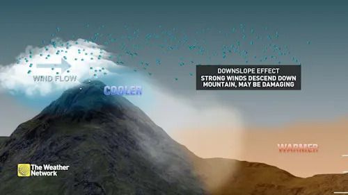
Powerful winds roaring down the mountains, known as Chinook winds, warm up and dry out as they race toward lower elevations. A Chinook wind event can send temperatures soaring as much as 20 degrees in a short period of time.
WATCH: The link between migraines and Chinooks in Alberta
Click here to view the video
تم ادراج الخبر والعهده على المصدر، الرجاء الكتابة الينا لاي توضبح - برجاء اخبارنا بريديا عن خروقات لحقوق النشر للغير


