

اخبار العرب-كندا 24: السبت 27 ديسمبر 2025 11:20 صباحاً
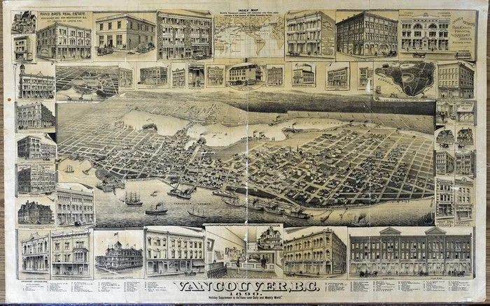
The Vancouver World claimed to have produced 20,000 copies of its 1890 panoramic map of Vancouver, which purported to show every building in the city from a “bird’s eye view” in the sky.
If true, that was quite a feat, given the 1891 Henderson’s City of Vancouver Directory said the city’s population was only 15,522 in 1890.
In any event, it remains one of the great images of early Vancouver. The black and white map was done by the Elliot Publishing Company of San Francisco, which did similar maps of cities up and down the west coast.
Advertisement
Advertisement
Advertisement
Advertisement
Vancouver was only four years old at the time, and was still centred in Gastown. There was virtually nothing east of Campbell Avenue in Strathcona or south of False Creek, and most of the West End was still vacant — the city pretty much ended at Broughton and south of Davie.
In 1898, The World decided to do another one — in colour. The cost was 50 cents, double the 25 cents people paid in 1890. (A smaller version also seems to have been handed out to World subscribers.)
It was illustrated by Augustus Koch, a German-born cartographer who lived in Chicago, and printed by the Toronto Lithographing Company.
It’s a gorgeous map, and The World didn’t hold back in its hype.
“No other work, publication or view so clearly defines and familiarizes people abroad with the site upon which Vancouver is located,” said a World story on Dec. 23, 1898.
Advertisement
Advertisement
Advertisement
Advertisement
“Our unrivalled harbour in front of the city; English Bay to the west; and False Creek running from west to east through the centre of what is to be the Liverpool of the twentieth century.”
The map is richly detailed, showing houses, commercial and industrial buildings, railway lines, bridges, wharves and ships in the harbour.

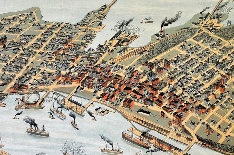
Detail from a historic bird’s-eye view map from 1898 published in the Vancouver World. This shows Gastown and its waterfront, and part of the downtown peninsula. Photographed Monday, February 28, 2011 in Vancouver, B.C. (Ian Lindsay/ PNG)
It illustrates the physical geography of the 1898 city, which was largely the downtown peninsula. The most striking thing to the modern eye is that False Creek ran up to Clark Drive — there was a bridge across Main Street, which was then known as Westminster Avenue.
Many commercial buildings were brick, so Koch coloured them a reddish orange, which really makes Gastown and parts of Granville stand out. The Canadian Pacific railway roundhouse in Yaletown is red as well. The buildings in today’s Yaletown are mostly wooden houses.
Advertisement
Advertisement
Advertisement
Advertisement
The details are uncanny — the churches have spires, many of the buildings have turrets, and some of the industrial buildings have smokestacks puffing away. Some of the steamships in Burrard Inlet have black smoke coming out of their stacks as well, but there are still a lot of sailing ships.
The Hastings Mill at the foot of Dunlevy is huge, with several ships at dock there. The nearby Rogers Sugar factory is drawn as an inset — it was east of the area illustrated.
Part of the CP Rail line in Gastown curves into a dock that sits in the water north of the CP station, a handsome Chateau-style building. There are houses throughout most of today’s downtown, and several more lumber mills along the waterfront.
The Vancouver Archives has a copy of the 1898 map, which was quite large (approximately 30 by 42 inches). A digital copy can be downloaded from its website. But originals are very rare.
Advertisement
Advertisement
Advertisement
Advertisement
“They’re just not surfacing,” said Don Stewart of MacLeod’s Books, who hasn’t had an original copy for sale in years. “When they do turn up in a frame, you could easily spend $1,500 on one at this point.”
The Library of Congress in Washington, D.C. has 41 of Koch’s 100-plus panorama/bird’s eye view maps, including an 1891 colour map of Seattle that looks similar to the 1898 Vancouver map.
The Library of Congress has a large collection of the maps, which it describes as “non-photographic representations of cities portrayed as if viewed from above at an oblique angle. Although not generally drawn to scale, they show street patterns, individual buildings, and major landscape features in perspective.”
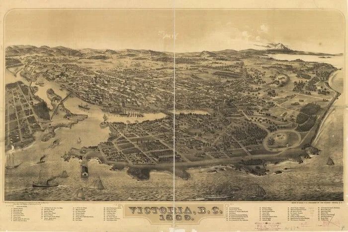
Among the 1,523 bird’s eye maps in the Library of Congress collection are four from B.C., which you can search online. But they are all of Victoria.
jmackie@postmedia.com

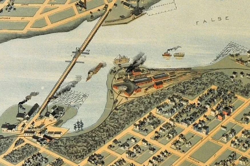
Detail from a historic bird’s-eye view map from 1898 published in the Vancouver World. This shows the Canadian Pacific Railway Roundhouse in Yaletown and the False Creek waterfront. The 1891 Cambie Bridge is to the left. Photographed Monday, February 28, 2011 in Vancouver, B.C. (Ian Lindsay/ PNG)

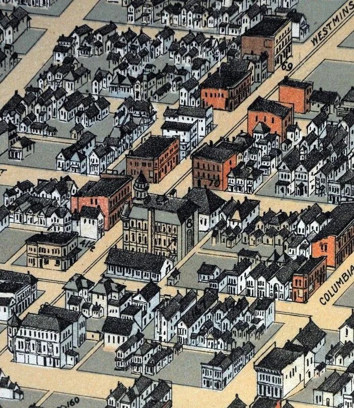
Detail from 1898 bird’s eye map of Vancouver showing Westminster Avenue, which is now Main Street. The big brown building with the turret was city hall at the time.

Copy photo of an historic bird’s-eye view from 1890 originally published in the Vancouver World and now at the City of Vancouver Archives Monday, February 28, 2011 in Vancouver, B.C. (Ian Lindsay/ PNG)

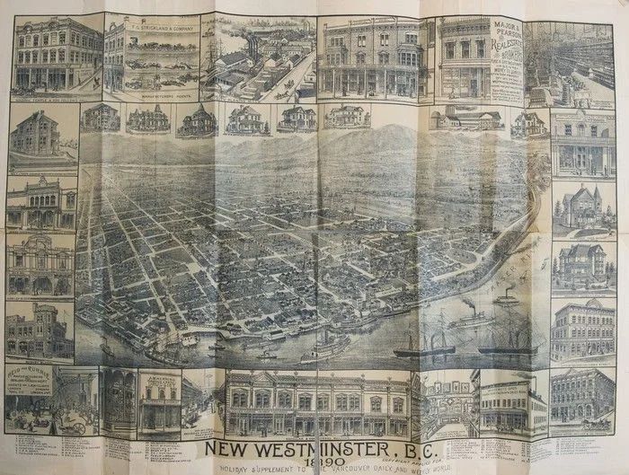
A “bird’s eye view” map of New Westminster from a Dec., 1889 “holiday edition” of the Vancouver World is among the historic documents that used to belong to Francis Carter Cotton, the owner of Vancouver’s first newspaper, the News-Advertiser, Port Coquitlam August 11 2015.
Advertisement
Advertisement
Advertisement
Advertisement

Bird’s Eye View map of Victoria, 1889. From the Library of Congress collection.

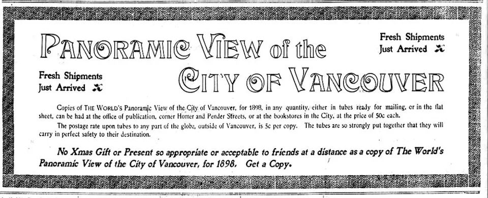
Ad for the Vancouver World’s “Panoramic View of the City of Vancouver” map in the Dec. 27, 1898 Vancouver World.
تم ادراج الخبر والعهده على المصدر، الرجاء الكتابة الينا لاي توضبح - برجاء اخبارنا بريديا عن خروقات لحقوق النشر للغير