
اخبار العرب-كندا 24: الأحد 7 ديسمبر 2025 10:44 صباحاً
The wintry weather will continue across the Maritimes to start this week with more snow, gusty winds and another round of very chilly temperatures.
An incoming Alberta clipper will be riding along a cold air boundary that will push into the Maritimes throughout Sunday night and Monday.
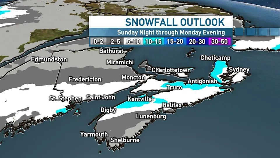
As of now, it appears Nova Scotia will see five to 15 centimetres of snow, with the highest totals most likely across the north, especially in the Cape Breton Highlands.
Advertisement
Advertisement
Advertisement
Advertisement
Areas along the South Shore will likely see less, and could even see a bit of rain mixing in on Monday.

The outlook shows much of the Maritimes will be getting snow overnight Sunday into Monday. (Ryan Snoddon/CBC)
Amounts will drop further to the north, but five to 10 centimetres are possible from southern New Brunswick to central P.E.I., including Saint John, Moncton and Charlottetown.
While this is a pretty typical winter system here in the Maritimes, it will be disruptive for travel.

(CBC)
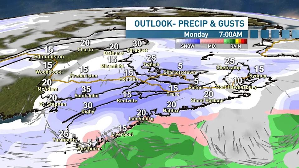
The snow will arrive overnight Sunday and into the early hours of Monday, with the morning commute looking snowiest for western and central Nova Scotia, as well as southern New Brunswick and P.E.I.
In these areas, expect the snow to be falling and accumulating on the roads during the Monday morning rush hours. Winds will be starting to kick up mid-morning with the potential for blowing snow over exposed areas.

(CBC)
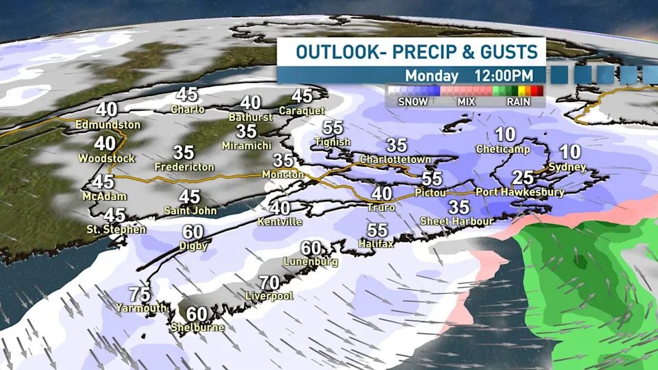
For the Northumberland Shore, Cape Breton and also P.E.I., the afternoon commute will be snowy and also windy, with blowing snow likely over exposed areas right into Monday evening.
Advertisement
Advertisement
Advertisement
Advertisement
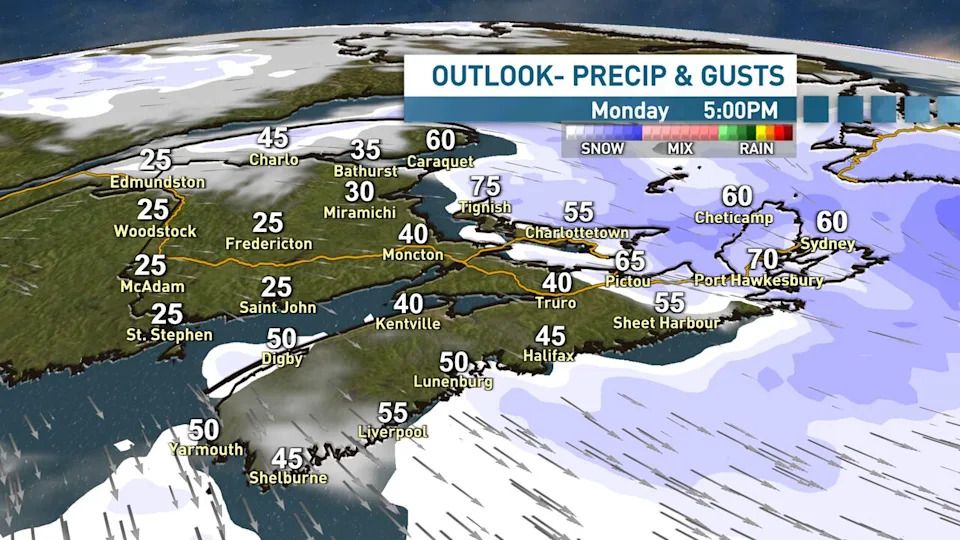
Conditions will be improving in the afternoon in the western and central areas of the Maritimes, with just a chance of lingering flurries, although the northwest winds will remain gusty.
Widespread wind gusts of 50 to 60 km/h are set for Monday afternoon, with some coastal gusts to 70 km/h, especially across eastern Nova Scotia, Cape Breton and P.E.I.
(CBC)
The northwest winds will be ushering in our next chilly air mass. Tuesday morning wind chills will be the –15 C to –25 C range for the Maritimes, with afternoon highs climbing to just –5 C in Nova Scotia and –6 C to –10 C in New Brunswick and P.E.I.
Temperatures will revert back to seasonal norms Wednesday into Thursday.
MORE TOP STORIES
تم ادراج الخبر والعهده على المصدر، الرجاء الكتابة الينا لاي توضبح - برجاء اخبارنا بريديا عن خروقات لحقوق النشر للغير


