
اخبار العرب-كندا 24: الجمعة 2 فبراير 2024 10:37 مساءً

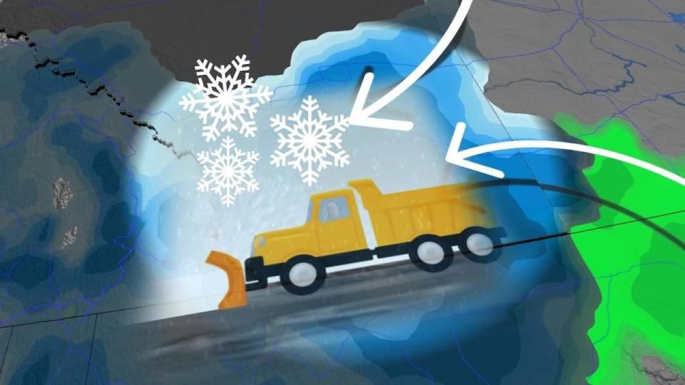
Folks across the western half of the Prairies are on the lookout for decent snows this weekend as a wintry system begins pushing into the region on Saturday.
A swath of double-digit snowfall totals will blanket communities from southern Alberta through northern Saskatchewan, making for slippery weekend travel throughout the region.
Plan for slow-going as a result of slick and snowy roads, and alter your travel plans if possible to avoid any delays or backups.
DON’T MISS: El Niño and the polar vortex take centre stage for winter’s final chapter
Few places on Earth lurch between weather extremes quite like the Prairies. It’s only been a few days since a town in southern Saskatchewan saw a whopping daytime high of 21.1°C, marking the province’s warmest January temperature ever recorded.

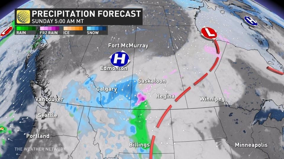
The days of all-time warmth are in the rearview mirror now as a disturbance moving over the border will usher in a spell of wintry weather across the western half of the Prairies.
Precipitation will begin moving across the international border into southern Alberta during the day Saturday, starting as snow at higher elevations and possibly rain in the foothills. Temperatures will fall as the sun goes down and force that rain to change over to snow as precipitation spreads from west to east.

Expect heavy snowfall along all major routes south of Calgary by Saturday evening, with flurries likely in Calgary proper.
MUST SEE: How Omega blocks and Rex blocks can affect Canada's weather
We’ll see the snowfall lift north into Red Deer, Oyen, and southwestern Saskatchewan by Sunday morning. Expect the snowfall to continue here through the day, moving north into Edmonton and Cold Lake by the evening hours.
Precipitation will continue spreading west to east into the day Monday, bringing flurries to Saskatoon and Prince Albert as the low-pressure system moves toward northern Manitoba.

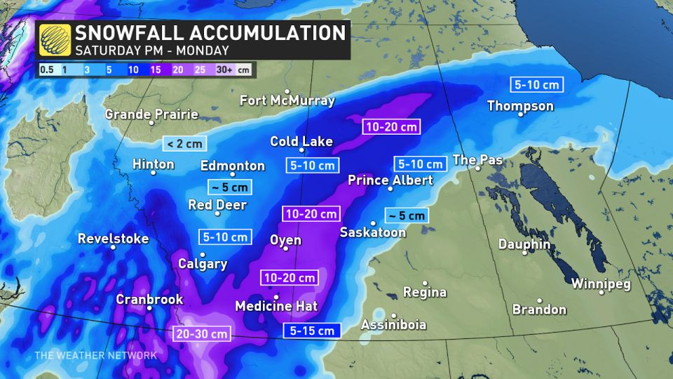
We’ll see general totals of 5-10 cm closer to Calgary and Edmonton in the west and Saskatoon and Prince Albert to the east.
Story continues
The heaviest snowfall totals are likely from far southern Alberta into central and northern Saskatchewan, where 10-20 cm of snow is expected across communities like Lethbridge, Medicine Hat, and Oyen. Locally higher totals are possible in the foothills right near the U.S./Canada border.
Temperatures across the Prairies will fall below freezing with the onset of this storm, remaining in minus territory for the remainder of the upcoming week.
Stay with The Weather Network for all the latest on conditions across the Prairies.
WATCH: What did Canada’s prognosticating animals predict on Groundhog Day?
Click here to view the video
تم ادراج الخبر والعهده على المصدر، الرجاء الكتابة الينا لاي توضبح - برجاء اخبارنا بريديا عن خروقات لحقوق النشر للغير


