
اخبار العرب-كندا 24: الخميس 4 يناير 2024 09:08 مساءً
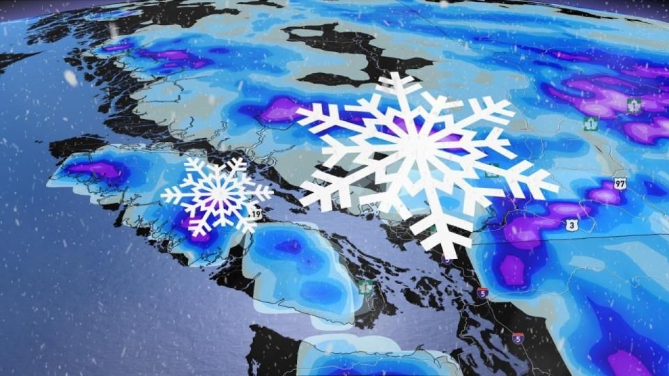
One round down, one to go. Another batch of rain and snow will arrive on British Columbia’s South Coast from Friday through Saturday, pushing freezing levels quite low and blanketing ski resorts with a much-needed infusion of snow.
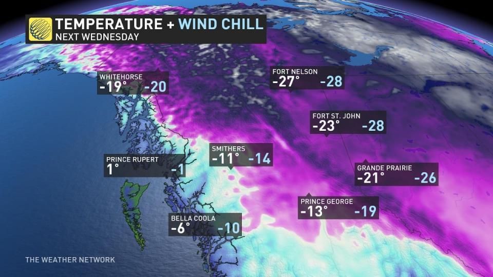
A big shift in the pattern next week will allow frigid air to gradually slide south across B.C, pushing some northern communities deep into the -20s by the middle of the week.
MUST SEE: Winter to finally show up in January as El Niño bested by polar vortex
Any snow is welcome these days as B.C.’s mountains are running a serious snow drought by this point in the season. Whistler is running far below average for the beginning of January, only recording about 20 percent of its typical seasonal snowfall total of more than 10 metres.
Alongside this weekend’s system, an impending pattern change could help turn that snowfall deficit around for ski resorts across the region.

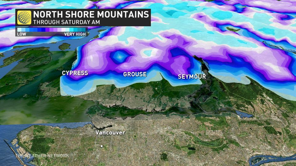
A system arriving on the coast will bring heavy low-elevation rains and mountain snows above 800 m beginning Friday morning and continuing through Saturday morning.
Metro Vancouver will stay above freezing during this event thanks to the warmer waters, but snow is likely north of the city at elevations above 600-800 m.
DON'T MISS: The chilling truth behind wind chill and its impact on our well-being
B.C.’s Interior will also see several rounds of snow through the weekend, potentially leading to slick travel through the mountain passes on Friday and Saturday. Plan ahead for delays and slow going on snow-covered roadways, especially through Rogers Pass and Eagle Pass along the Trans-Canada Highway.
Looking ahead, a frigid pattern descending on the western half of Canada will allow temperatures to steadily fall across northern B.C. heading into next week.
Temperatures will get progressively colder into the middle of the week, with communities in northern reaches of B.C. falling into the -20s with wind chill values closer to -30.
Stay tuned to The Weather Network for the latest forecast updates across B.C.
WATCH: January finally drags winter back to Canada
Click here to view the video
تم ادراج الخبر والعهده على المصدر، الرجاء الكتابة الينا لاي توضبح - برجاء اخبارنا بريديا عن خروقات لحقوق النشر للغير


